 Dateline: San Cristóbal de las Casas
Never give up. That sounds like trite, tired advice, right? Well, it often is, but as with all such hackneyed phrases, there’s more than a grain of truth there. After the heat of Valladolid, I was eager to get to the highlands as quickly as possible. The airconditioning on my truck had started to work erratically, and I worried that it would give out entirely. Though Joanna had recommended it, and despite it being right in my path, I was ready to skip Campeche entirely. But as you can see from the prior post, luck intervened, and I had a very nice two days in Campeche.
But two days was enough for Campeche, and I longed to get to higher ground. My next destination was Palenque, and I was eager to see this ancient, Mayan City. According to my research, it had an unparalleled urban plan, many very fine temples, and plenty of intact sculpture. So I set my course to Palenque, and made the drive there.
The town of Palenque isn’t much to blog about. It’s kind of the Cancún of the foothills of the southern Sierra Madre, minus the lovely resorts, beach, and seafood. Which is to say that it’s pretty modern and generally lacking in “Ye Olde Mexican Charme.” Or, more plainly put, totally boring. But I found a decent hotel, with air conditioning (a must), for a very reasonable 350 pesos, and the guys at the desk were nice, and there was also free, gated parking. So what’s not to like?
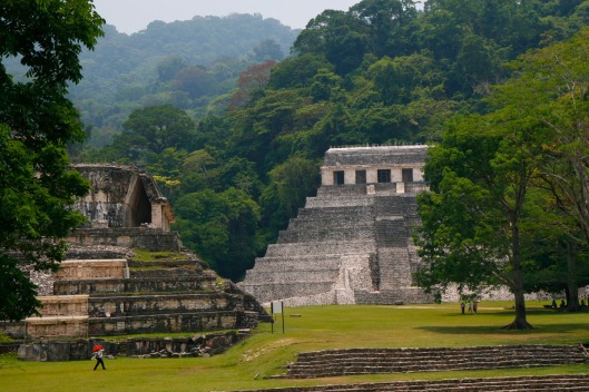
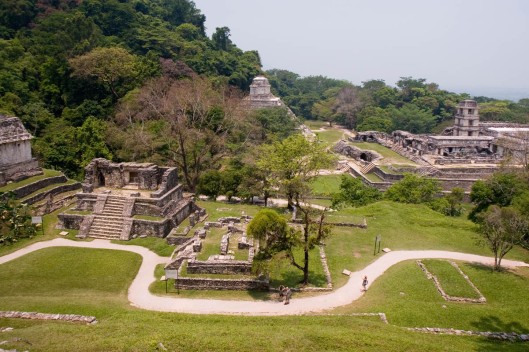
The next day I went to see the ruins, and I was not disappointed. The setting is spectacular, deep in a verdant jungle, wrapped in a mysterious blue mist that completely obscures the tops of the surrounding mountains. And it seems pretty obvious to this casual observer that the city of Palenque must have been a good deal richer than many other Mayan cities due to the obviously richer topsoil and growing conditions. Remember, Uxmal sits in a relatively arid part of Yucatán, and the city is festooned with shrines to Chaac, the Mayan god of rain. This means water was in short supply. And the same appears to be true of Mayapan, relatively arid with very thin topsoil. But in Palenque, the jungle is luxuriant and thick with trees. A still-functioning aqueduct runs through the ruins. Each tree is covered with vines, and various epiphytes such as orchids, bromeliads, and other plants which I don’t recognize. Banana trees grow wild along the road, and there are also plenty of coconut palms too. How could an ancient city located in such an apparently fertile region not be relatively prosperous?
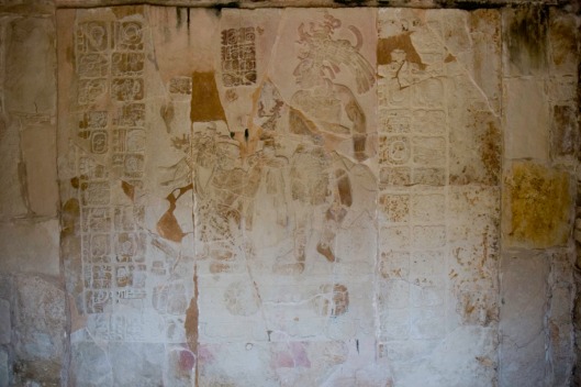
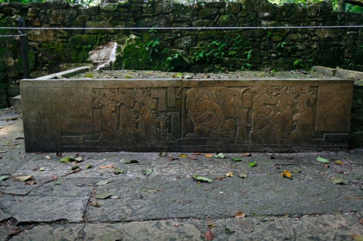
And the scope and scale of the city give testament to this observation. In its heyday, Palenque must have been truly awe-inspiring. Now, most of the city remains buried under the verdant jungle foliage. I would guess that only about a fifth of the ancient buildings have been excavated and restored. But those buildings which have been restored are magnificent, many with remaining plaster sculptures on the facades and interior walls. There are also a number of stone tablets that really show the beauty of Mayan art. Graceful figures in bas relief rival anything produced during the Classical period in Greece. The hieroglyphs, though unreadable to this traveler, are also beautiful in their own right. Sadly, the bas reliefs are poorly lit, and don’t photograph well. Worse, some are deteriorating due to incursion of water which is leading to algal growth. Left unaddressed, these problems will probably destroy this art within a generation. You should also note that most of the “good stuff” requires a hike to the top of the temple, something that to my surprise, many visitors didn’t do.
The site of Palenque itself is also a wonder. Because of the lush jungle, the site appears like a large, well-groomed park. During my visit, exotic flowers were blooming, a number of trees were in bloom, and others were simply splendid in their broad, leafy greenness, providing both beauty and much-needed shade. The temperature was about 97°F and probably 100% humidity. Because of this greenness, the temples are separated by broad stretches of lawn. And unlike Chichén Itzá or Mayapán, which are located on plains, the people of Palenque were able to utilize the terrain as part of the urban design. And certain temples are built into the hillsides, adding to the grandeur of the overall site. I was eager to explore.
But after about three hours of climbing up and down pyramids, I was spent, and my shirt was literally soaked through. Given the humidity, there seemed to be little prospect of it ever drying, so I put on a fresh one. But even that didn’t help much. By this point, I had seen everything except the museum. When I saw that the only parking to the museum was in the blazing sun, I said, “to heck with it,” and set course for San Cristóbal de Las Casas on Carretera Federal 199.
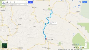
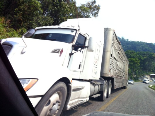
Joanna had warned me about this road. “There are 299 topes,” she said. “We counted them on our last trip there.” I also knew that the road wound through the mountains to get to San Cristóbal, which lies at an altitude of 2,100 meters, or 6,900 feet. So I knew that I was in for a lively drive. And Joanna had also warned me that I’d likely get stuck behind big logging trucks on this highway. What I didn’t know what that this highway was to be the worst drive of my life.
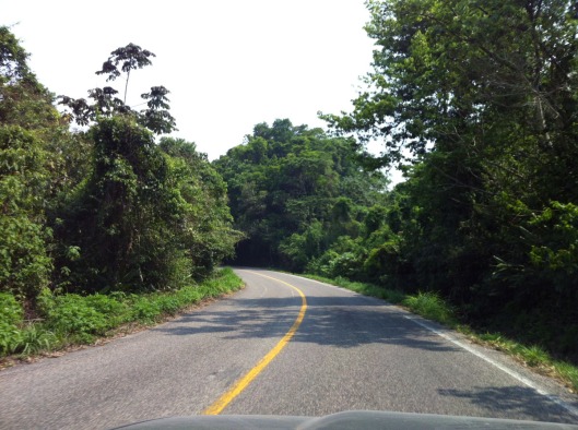
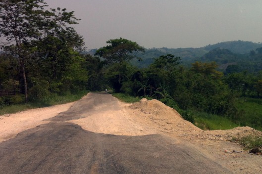
Initially, the road seemed good enough. Yes, it’s a two-lane secondary road that winds through the jungle. But I was up for a windy road, having expected as much. And I was ready for topes too. But after about 20 kilometers or so, the condition of the road deteriorated drastically. There were severe dips on the edges of the road. There were potholes. None of this was too challenging, though I did have to pay attention. But then I came across a sign that said, “Deslave – 100 metros.” “Deslave,” I thought to my self. “That’s one I don’t know. Sounds like something to do with water or washing. Hmmm…” But soon enough, I learned the meaning of “deslave.” It means that as much as 2/3rds of the road has been washed down the hill. So the formerly two lanes becomes about a third of a lane.
Fortunately, for my first “deslave,” there was no other car in sight, and duly warned and traveling at a moderate speed, I just drove around it. But as I continued, I realized a few things. First, there were plenty more deslaves. And second, not only were there other cars on the road, but they included 18-wheelers, and full-sized tourist buses. Yikes! I was terrified of meeting one of those at a “deslave.” Fortunately, I was lucky. Not only did I not encounter an oncoming large vehicle at any deslave, but I was fairly easily able to pass slower-moving vehicles when I did encounter them.
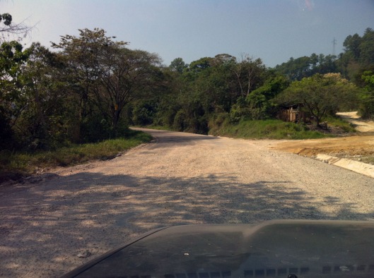
However, as I went along, the road continued to worsen. At stretches, the pavement disappeared completely, to be replaced by stretches of dirt and gravel, studded with potholes that would have swallowed a lesser vehicle. Thank God I was driving my truck, which handled all the obstacles with aplomb.
Three hours passed, and I had only driven 90 KM, about 56 miles. I finally reached Ocosingo, Chiapas, about halfway to San Cristóbal. I had a decision to make. If the next 100 KM were as bad as the first 90, I was in serious danger of having to drive this awful highway in the dark. I drove through Ocosingo, and mentally calculated. “It’s about 5:00 now. If the next stretch is as slow, that means I’ll get to San Cristóbal by 8:00. Might I get there sooner? Or will I end up driving in the dark, at risk for god-knows-what dangers?” I realized that it’d be foolhardy to continue. This highway was such that literally any wrong move could have resulted in disaster. Anything could happen — hitting a bad patch at speed, or plunging over a cliff, hitting an animal, or worse, a person. No. I had to turn back. I even considered going back to Palenque and skipping this part of the journey, but I realized I was half way, and that beyond San Cristóbal, the roads would improve. I wanted to give up, but I didn’t, so I spent the night in Ocosingo.
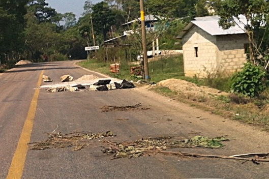
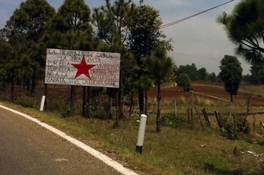
The sign below reads, “The land belongs to those who work it. For that we live, for that we die. No to the highway. Zapata lives. The struggle continues.”
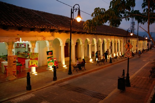
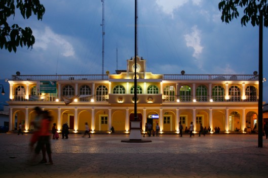
There’s not much to be said about Ocosingo. It’s a little town in the mountains with about 35,000 inhabitants, a nice little town square, and a lot of minibus stations. After settling into a hotel, I wandered the plaza for a bit, where I was accosted by some young people who were hoping to practice their French with me. I said I’d give it a shot, but my French is pretty rusty. Turns out they are students at “Universidad Technológica de la Selva,” or the Technical University of the Jungle, something which I found quite amusing. But I didn’t let on about my amusement, as they were very nice young people. I did try to persuade them that English would be a much more useful second language than French, but we’ll see where that goes. We finally settled on Spanish for conversation, and had a nice chat about the city, what they planned to do in the future, and what to see while here. They tried hard to persuade me to stay a couple days in Ocosingo and let them take me sightseeing, but I had to decline as I’m beginning to feel the need to head back north soon.
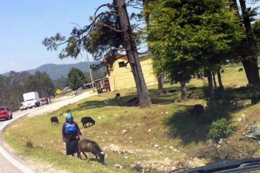
After we had chatted for about an hour, I begged off and headed back to my hotel. What would the second leg of my drive be like the next day? I fell asleep pondering that question. Though I’ll save impressions of San Cristóbal for a subsequent post, I am there now, and am glad I didn’t give up. It’s a terrific place, and worth even the horrendous drive. Saludos!!!
P.S. This post would have arrived sooner but for a now-resolved emergency that arose in Boston last night.

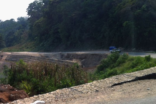
Yes, the trip to San Cristobal de Las Casas is one to remember. We left the motorhome in Villahermosa and took Mex 195 down and returned on the longer but slightly better Mex 199 through Palenque, the route you took. There were just as many washouts then as there are now and from looking at your photos some may even be the same. The Mexican Government does not appear anxious to spend money on infrastructure in Chiapas.
Our highlight was following a large truckload Federales up a very steel incline when a large out of control truck coming downhill with no brakes came within inches of both of us. They did not stop. We were carrying on a great conversation with the police in the back of the truck with hand signs through the windshield at the time. It was scary when it happened but amusing afterward.
LikeLike
Wow, Croft! That’s an AMAZING story. Good God! On the highway from Tuxtla to Coatzacoalcos, there were plenty of those gravel pits for emergency stops too. In my post “From High and Dry to Low and Wet,” post, I wrote a bit about out-of-control trucks. Bottom line? I never want to encounter one. By the way, smart move leaving the motor home behind. Thanks for your comment, and again on road advice! Saludos.
LikeLike
We did a bit of research and discovered the cost of fuel for the motorhome would far outweigh the price of a hotel for a few days. Seeing the width and condition of the road made this an even smarter decision!
LikeLike
Croft: that’s a smart way to look at it. I am in the middle of doing a similar calculation on leaving my truck in Laredo in storage and flying back to Boston with the idea of coming back in a month or two. Saludos and thanks for the great comments.
LikeLike
Thank you for taking such great photos! You are saving me a lot of time and gas by giving me a ride-a-long to places I have only heard about , some of which I will probably never get to see!
LikeLike
Hola Tancho! Thanks for the kind words on the photos. I put a lot of effort into them, so I very much appreciate the kind feedback. Saludos!
LikeLike
Thanks for another leg of your trip, in turn taking me down memory lane. Palenque is, by a country mile, my favourite set of ruins of any type anywhere. Probably.
The worst trip I have also ever taken was to San Cristobal. And from. A horse ride up mountain tracks. On a wooden saddle. With tree branches that cross the path cut back to avoid banging your head on them – providing you are 5’5″ tall, Otherwise, you’re screwed. It went on for three hours up and three hours back.
Oh, that wooden saddle. I couldn’t sit down for a week. Don’t do it….
This was also the place I was told not to photograph any of the locals, as they believe the camera steals their souls. Souls, it turned out, were as readily available for purchase. About 10 pesos a pop at the time.
LikeLike
Ah Gary, what a hysterical comment. “As long as you’re only 5′ 5″ tall.” LOL. It’s tough being tall in Mexico, and you have it worse than I do. And the souls for purchase at 10 pesos a pop, LOL. I’m not going to any of those places as I don’t handle that kind of thing well. Saludos and thanks for commenting.
LikeLike
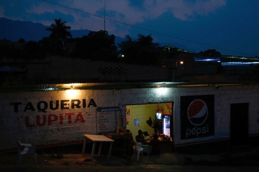
Oh, the fun you have while I deslave away at work. This post is quite revealing in its depictions of not just the ruins and roads, but how society works… imagine walking in Boston and being approached by strangers to practice French. The photos of the taco joint and the plaza make me yearn for another trip sooner rather than later.
LikeLike
Hi Lee. Being approached by strangers to practice English is VERY common in Mexico. Students are commonly asked by teachers (at least in DF) to go hunt down a “gringo suelto” and to interview him in English while videotaping it. I can’t tell you how many of those I’ve done, but it’s a lot. But I’ve also had plenty of chats in the plazas of Mexico that had nothing to do with English. People are just more friendly here. That’s part of what I like about the place. And I hope you get another trip sooner rather than later. Saludos!
LikeLike
Well… you made it. I “neglected”to tell you about the deslaves because I feared you’d back out of San Cristobal… and now you see what you would have missed. I am relieved you stayed the night in Ocosingo… you are a sensible soul. The rest of your trip will have its moments, but I think you’ll be hard pressed to find a more memorable state than Chiapas… it makes a person ponder… about a lot of stuff we are normally able to avoid thinking about. Don’t you agree? Kim, after this journey through Mexico is over you’ll never look at things in quite the same way. I hope you are keeping the book idea alive. It would be a doozey… and so helpful to other adventurous travelers…
LikeLike
Joanna! LOL!!! It had indeed crossed my mind that you might well have “neglected” to tell me about the deslaves. And now your comment really makes me chuckle. And I agree with you about Chiapas. I’ve spent a lot of the day thinking about the indigenous people, their displacement both historically and currently. (See my reply to Steve.) As you know, today is Día del Niño, and the plaza had loads of indigenous families, all lined up for toys for the kids, and boxes of food aid. While the kids were ecstatic, I couldn’t help but think of the plight of poverty that the families were living in. It appeared that many had waited in line for hours, and there were no güeros in line. Also, all the music and the program were in Spanish, but a lot of those folks were Tzotzil speakers. I wondered too about the well-being of their language. I’m pondering thoughts to try to work this into a post. Saludos, and thanks for commenting.
LikeLike
P.S. As noted to Norm, I didn’t “hate” the drive. I only found it quite challenging and tiring. The curvy bits of good pavement were fun.
LikeLike
San Cristóbal de Las Casas was on my list of places to live in Mexico. After visiting there last year, it jumped several spots on my list. Its biggest drawback is its isolation. What am I saying? At least, San Cristóbal de Las Casas has colonial buildings and infrastructure. Plus a bevy of Evangelical Christians street vendors — with their own fascinating tales.
I am looking forward to hearing more.
And thank you for letting me visit Palenque again. It may be my favorite Maya ruin.
LikeLike
Hi Steve! I have to say, I like this place more than I thought I would. There’s definitely a good vibe here, a fair number of foreigners, though mostly not Americans. I’ve heard lots of French and German spoken, with a smattering of what sound like Nordic tongues, along with a couple of Spaniards. But the gringos are few and far between. However, it seems like it’d be a good place to live, and the foreigners bring things like nice restaurants, etc.
As for your comment on the street vendors, I am fascinated by them and the other indigenous people here. I am aware that some of them have been expelled from their villages for becoming Protestants, though I don’t know much more. But I’m drinking in the Tzotzil I hear around me, and working on some ideas to write about it. Thanks for commenting, and saludos!
LikeLike
Ah, topes and deslaves! I plan to drive from Queretaro to Tulum this August, via San Cristobal and Agua Azul. And back, but perhaps not through the mountains, just hugging the Gulf. Did you happen to pass many “citizen tollbooths”? I haven’t seen them much outside of the Veracruz state, but they are ubiquitous there, particularly after storms. I have learned to speed up, as the taxis and truckers do, if the guys holding up the chains aren’t carrying shovels and the potholes/deslaves don’t look freshly filled. But I don’t really mind the notion of tossing a few pesos to teenagers who bothered to fill a few rim-busting potholes with dirt — it certainly makes the worst parts of the roads a bit easier to negotiate. Still, 56 miles in three hours isn’t reassuring…..
LikeLike
Hi Don Alberto! I so far have not passed any citizen tollbooths, though they have been at the back of my mind. I have heard they are more prevalent in Michoacán, but I don’t really know. There was one suspicious tollbooth as I crossed into Ciudad del Carmen, but I think it was probably legit. However, the government tollbooths are plenty rapacious themselves. I’ve probably spent close to $150USD on tolls so far. Also note that the highway through Veracruz south is rutted (though nothing compared to the topic of this post) and there are lots of tolls. Thanks for your comment. Subsequent ones will appear right away. Saludos!
LikeLike
I am delighted that the billboard notes that I am still alive.
LikeLike
And we all know, comrade, that you are there, shoulder to shoulder with your fellow Zapatistas fighting against the capitalist oppressor. ¡Vive Chiapas!
LikeLike
Hahhahahahhaha! (Good one.)
LikeLike
I couldn’t resist! Saludos.
LikeLike
I WAS really beginning to wonder IF you had gone off a cliff. I’m so glad I came home today to a post! A wonderful one at that. The road you traveled, believe it or not, is better then any of the roads were in the 70’s from Laredo to Guadalajara! But, I’m sorry you traveled on that……..IF you ever get to SMA again, I’ll introduce you to an amazing woman who was the secretary to the archaeologist and his wife, Frans Blom who discovered Palenque! (It had been discovered previously I believe and then forgotten). Her stories of their flying in a single engine plane into the jungle were hair-raising but fascinating. I do hope you get to Nabalom while in San Cristobal. And to Chamula and Zincantan, if not anywhere else……..so close to San Cristobal and so worth it! I’m envious. Wish I was back down there. San Cristobal was one of my biggest surprises in Mexico! So wonderful. I could so live there!
LikeLike
Barbara, I’m glad that we are both on the same side of the “Kim over the cliff” issue, LOL. I was just reading today about the Bloms. Chiapas is a truly fascinating place, and San Cristóbal has a great vibe. I’m torn between spending more time here or with Edgar. But as we used to say in the business, it’s a high-grade problem. Saludos!
LikeLike
Ohmyohmy….!
LikeLike
This truly is an adventure. Way better than I could have imagined. Saludos!
LikeLike
It’s a good thing you were not “desvelado” when you encountered the “deslave”.
Traveling through the Andes mountains there are plenty of deslaves, they often happen overnight. The crosses on the side of the road reassure it’s been there for sometime and not an unpredictable and treacherous trek…
LikeLike
Andean: your first paragraph made me laugh out loud. Thanks! And yes, I’m sure there are many worse roads farther south. Thanks for the comment and Saludos!
LikeLike
I’ve just read this: http://anageonism.wordpress.com/2014/05/01/travel-horrors
It me laugh out loud and reminded me of the ‘deslave post’ 😉
LikeLike
Simone: Thanks for sharing! I enjoyed that post. Saludos.
LikeLike
The market in San Cristobal has the best wool clothing. The sox are of the kind our forefathers pulled over their feet, well worth the effort of scouting out the craft market.
If you hated the Palenque-San Cristobal road, don’t go to Guatemala…
LikeLike
Norm: I’ll have to look for those socks. The textiles here are beautiful. And yes, I’d imagine that the roads in Guatemala are FAR worse. Thanks for commenting and Saludos.
LikeLike
PS. I didn’t exactly hate the road, but it was a whole lot more effort than I had imagined. Fortunately I grew up driving on twisty, dirt roads, so I’m pretty good at dodging potholes. And I’ve also driven far enough in Mexico that I’m now doing all the crazy Mexican stuff like passing buses and trucks at topes, LOL.
To me, the most surprising thing about that road is the fact that it’s a “federal highway” with a 3 digit number attached to it.
LikeLike
My last time across that road, I was in a bus with a transmission that would not go past # 6 of 13, it was a slow ride. But I got to see the countryside in detail.
About 5 years ago, I was over on the Guatemala side of the border visiting a Peace Corp village couple. At night the border with Mexico was evident by the increase in household lighting on the Mexican territory. The San Cristobal area is well-to-do compared to the land on the other side of that little black line on my map. .
LikeLike
Norm, on a per-capita basis, Mexico is the second-richest country in Latin America, after Chile, but well ahead of the rest. And as you know, Central America is a place of grinding poverty, something that’s been hammered home to me by Laurie Matherne’s blog. As for the bus, I’m not sure you’d want to be in a bus that would go much faster. I wonder if that bus hadn’t been intentionally limited to prevent loss of life. Thanks for your wonderful comments. Saludos.
LikeLike
Hi Kim,
Glad you made it to the incredible ruins of Palenque, and even gladder that you made it to San Cristóbal safely. That road is a challenge. I traveled it in the late 90s… fortunately it was a Mexican friend that was driving. Beautiful scenery, but I wouldn’t want to negotiate the constant curves and topes. However, it would seem that the highway has deteriorated greatly since then. I don’t remember any “deslaves”… that’s a new word for me too.
I was in Ocosingo (wise decision to spend the night there!), and although the town itself is nothing special at all, nearby are more Mayan ruins… the site of Toniná… which in some respects is as amazing as Palenque. The ruins are built up the mountainside. You climb up and up and up, until at the top there is an spectacular view of the valley below. But after that drive, I’m sure you just wanted to move on to San Cristóbal!
I look forward to your next post.
Saludos y abrazos,
Bill
LikeLike
Hola Bill! If I weren’t starting to feel a bit pressed for time, I’d have loved to see Toniná and Yaxchilan as well as other sites there. But Edgar is chomping at the bit to have me return to Puebla, so who am I to disappoint him? Thanks for your fantastic comment as always. Saludos.
LikeLike
Hey, you can’t see everything on one trip (although you have seen an enormous amount of Mexico). Besides, Puebla is beckoning!
Saludos
LikeLike
Bill: with each day, I’m growing more conscious of how big a country this is. Saludos.
LikeLike
There’s nothing like a dose of Schadenfreude to make your readers feel happy and good!
LikeLike
We aim to please! Saludos.
LikeLike